
Colorado Springs panel to review mixed-use plan near Cucharras and 21st
The conceptual plan covers about 5.4 acres and includes a traffic-study scenario with 60 apartments, a 120-room hotel and commercial space.
Published at
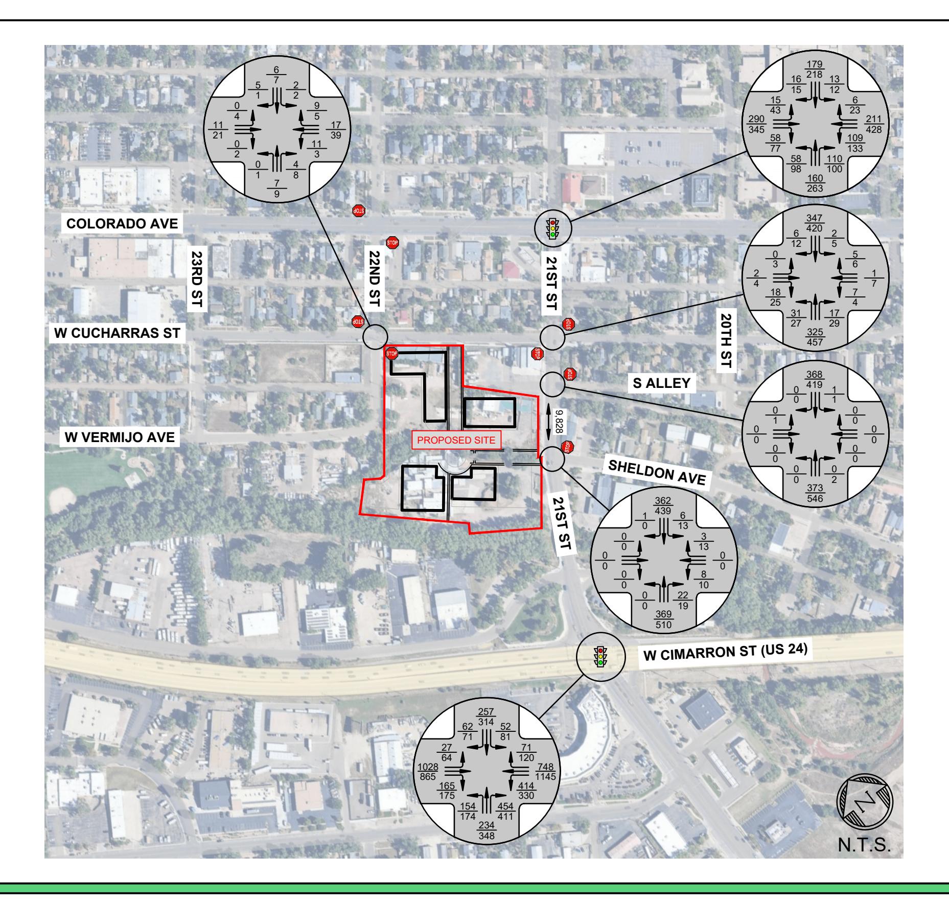
The Colorado Springs Planning Commission is scheduled to review a rezoning and conceptual land-use plan Nov. 12 for about 5.4 acres at the southwest corner of West Cucharras and South 21st streets. City staff found the applications meet approval criteria, and the commission may make a recommendation to City Council; no decision has been made. The staff presentation identifies the site and outlines the review.
The traffic study models a development mix of 60 apartments, a 120-room hotel and about 35,000 square feet of retail, office and restaurant space. It estimates that scenario would generate 3,493 vehicle trips on an average weekday. The conceptual land-use plan proposes mixed-use zoning with a Streamside Overlay, but does not fix the eventual uses or their exact mix and intensity. A development plan and subdivision final plat, along with later stormwater and geologic-hazard reviews, would still be required before development.
The concept sets maximum heights of 35 feet on about 0.66 acre and 50 feet on about 4.67 acres, with the lower-height area next to existing homes. Road layouts, access points and their design remain conceptual and could change during development-plan review.
The traffic study models the project opening in 2028 and forecasts conditions through 2048, assuming 1% annual background traffic growth. At the U.S. 24 and 21st Street signal, it projects an overall level of service (LOS) grade of E by 2048 under existing signal timings, with some approaches at E or F. The study projects LOS D or better at all approaches if signal timings are optimized. These are forecasts of future delay, not measurements of current traffic. The study recommends no project-related signal, road-design or capacity improvements. It also projects an LOS E for the westbound stop-controlled approach at Cucharras and 21st during the 2048 evening peak, but says the delay would not warrant a traffic signal. The development site is at Cucharras and 21st; the U.S. 24 intersection is included in the study's traffic analysis. The traffic study describes its assumptions and projections.
The plan calls for a 25-foot-wide trail-corridor easement to be provided with the final plat for a future city-built connection beside Fountain Creek. It also depicts a private trail that could potentially become part of a publicly built and maintained Midland Trail segment, subject to future city trail planning. Streamside buffers and a proposed detention pond are included, with drainage and channel details left for later review.
The staff presentation records three written comments, including support for and opposition to the applications. It also summarizes neighborhood concerns about local-street traffic, building height near homes, density and neighborhood change.